
Elevation Mapping & Data, Surveying, & Farm Drainage Design
-
LiDAR Elevation Data & Mapping
-
RTK Elevation Survey
-
Ideal Ditch Mapping for Ditch Assist
-
Surface & Tile Drainage Design
-
3D Land Level Design


DITCH ASSIST MAPPING
Ideal Ditch Maps
Using LiDAR or RTK elevation data, we will model your field’s natural drainage. Following these routes while ditching will provide the optimum surface drainage perfromance with the least amount of earth-moving.

For Ditch Assist owners we supply you with map overlays that you can easily follow while ditching
- Optimum routes to follow to create drains
- Most effective drainage with minimum earth moving
- Identify depression areas
- Overlay maps in Ditch Assist for easy ditching

TILE DRAINAGE DESIGN SERVICES
Tile Drainage Design
Our professional tile drainage designs will make tiling yourself a reality. Let us design your tile system, calculate the required pipe sizes, and tell you what you need. We also supply you with install parameters (minimum, maximum, and target depths for mains, sub-mains, and laterals) for Intellislope so you know what you need to do on every run – no nasty shocks when something doesn’t line up!
- Tile designs that maximize your ROI
- Pattern tile or target specific areas
- We calculate pipe sizing and amounts required
- Install parameters provided for Intellislope

3D Land Level Designs for Ditch Assist
Land Leveling Designs
An alternative to surface drainage that is popular in many regions is land leveling. Unlike traditional leveling planes that require significant earth moving and disturbance, we can design a best-fit surface. This fills in depressions, and gently grades specific areas so that the entire field drains to the edges and there is nowhere that water can pond.
Ditch Assist and Trimble Field Level II owners can load these designs and undertake whole-field or target area land forming themselves without needing a contractor

LiDAR ELEVATION DATA
LiDAR Data & Mapping
Where available in Manitoba and Alberta we will create detailed elevation maps of your field(s) using high-resolution LiDAR data. Data may also be used in Ideal Ditch, surface & tile drainage design
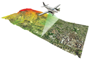
- High accuracy, high resolution elevation data
- Significantly lower cost than RTK survey
- High quality printed & digital maps
- Use data in your own software or our other design services

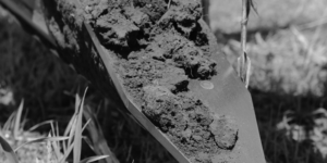
RTK ELEVATION SURVEYING
RTK ELEVATION SURVEYS
In most areas of Manitoba and Saskatchewan we are able to provide high-accuracy RTK elevation surveys. Using survey-grade equipment we will map the elevation of fields and surrounding features to create high-resolution data suitable for terrain modelling and subsequent tile or surface drainage design.
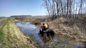
- High accuracy, high resolution elevation data
- Experience in providing this service since 2008
- Most accurate data option for tile drainage design